Provides an exploration of Australia, Oceania, and Antarctica, discussing their climates, wildlife, natural landmarks, industries, sports and more, using maps.
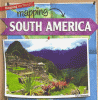
Readers will learn many fascinating facts about the geography of South America. Colorful photographs and detailed maps introduce them to a continent full of high mountains, bustling cities, and fertile grasslands.
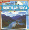
Including the Great Plains of the United States and the huge icebergs of Greenland, North America is a continent with a wide range of geography, climate, and cultures. Colorful photographs will invite readers to visit the many scenes North America has to offer?from the smallest Caribbean Island to icy northern Canada.