Presents an inclusive, multidisciplinary look at the triumphs and tragedies of the twentieth century through a combination of reproducible text, maps, charts, timelines, and drawings in loose-leaf format.
A visual narrative of world history with a collection of maps illustrating geographically the most significant periods and events in the history of civilization from the earliest times to the present day.
An illustrated introduction to coordinate planes that describes how scientists use coordinates to make better maps of the ocean; and includes a problem solving activity.
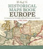
a country-by-country atlas of European history, 1700s-1900s
Dolan, Allison
2015
From Ireland to Italy, Portugal to Poland, Germany to Greece, and everywhere in between, explore your ancestors' European homelands through more than 200 gorgeous reproductions of 18th-century maps, 19th-century and early 20th-century maps. These full-color period maps--covering the peak years of European immigration to America--will help you understand changing boundaries in ancestral countries, and inform your search for genealogical records.
Presents a visual survey of global trends and current events, with statistics on population, life expectancy, ethnicity and diversity, literacy and education, urbanization, income, inequality, quality of life, and more.
Documents the distribution of breeding birds in the state of New York, as well as significant changes in bird distribution since the publication of the first edition, with color maps and an overview of each bird's breeding range, habitat preferences, history, and conservation implications.
Describes different ways to map the contours, bodies of water, climate, and weather of the world. Also discusses tectonics, geological maps, and satellites. Includes a mapping activity, color photographs, a glossary, and further resources.