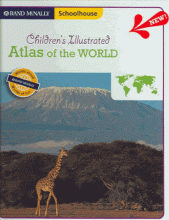
Children's illustrated world atlas
A comprehensive, illustrated children's atlas of the world that contains physical, political, and thematic maps, over 250 photographs, a time line, country flags and quick facts, and a glossary.
Rand McNally
2006
9780528934582
book
Holdings
| hid | mid | miid | nid | wid | location_code | location | barcode | callnum | dewey | created | updated |
|---|---|---|---|---|---|---|---|---|---|---|---|
| 1531428 | 5161265 | 2346 | 236739 | 344958 | WESE | 490 | WESE030154 | NF-COUNTRIES MAPS ATLASES | 1000 | 1581465224 | 1736518457 |
| 3099689 | 6546391 | 1562 | 236739 | 344958 | 8 | 394 | T 807705 | REF 912 CHI | 912 | 1640729255 | 1640729255 |
| 3099690 | 6546391 | 1562 | 236739 | 344958 | 8 | 394 | T 807706 | REF 912 CHI | 912 | 1640729255 | 1640729255 |
| 3099691 | 6546391 | 1562 | 236739 | 344958 | 8 | 394 | T 807707 | REF 912 CHI | 912 | 1640729255 | 1640729255 |
| 3099692 | 6546391 | 1562 | 236739 | 344958 | 8 | 394 | T 807708 | REF 912 CHI | 912 | 1640729255 | 1640729255 |
| 3099693 | 6546391 | 1562 | 236739 | 344958 | 8 | 394 | T 807709 | REF 912 CHI | 912 | 1640729255 | 1640729255 |
| 3099694 | 6546391 | 1562 | 236739 | 344958 | 8 | 394 | T 807710 | REF 912 CHI | 912 | 1640729255 | 1640729255 |
| 3099695 | 6546391 | 1562 | 236739 | 344958 | 8 | 394 | T 807711 | REF 912 CHI | 912 | 1640729255 | 1640729255 |
| 3099696 | 6546391 | 1562 | 236739 | 344958 | 8 | 394 | T 807712 | REF 912 CHI | 912 | 1640729255 | 1640729255 |
| 3099697 | 6546391 | 1562 | 236739 | 344958 | 8 | 394 | T 807713 | REF 912 CHI | 912 | 1640729255 | 1640729255 |
| 3099698 | 6546391 | 1562 | 236739 | 344958 | 8 | 394 | T 807714 | REF 912 CHI | 912 | 1640729255 | 1640729255 |
| 3099699 | 6546391 | 1562 | 236739 | 344958 | 8 | 394 | T 807715 | REF 912 CHI | 912 | 1640729255 | 1640729255 |
| 3099700 | 6546391 | 1562 | 236739 | 344958 | 8 | 394 | T 807716 | REF 912 CHI | 912 | 1640729255 | 1640729255 |

