Presents maps of Australia, the islands of the Pacific Ocean, and the continent of Antarctica, and provides information about the geography and natural resources of each nation.
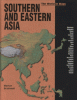
Profiles twenty-five countries in southern and eastern Asia, describing the geography, climate, economy, industries, and agriculture of each, and providing color photos and maps.
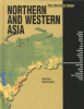
Profiles twenty-four countries in northern and western Asia, describing the geography, climate, economy, industries, and agriculture of each, and providing color photos and maps.
Provides information about the location, topography, climate, population, industry, language, and currency of the Central and South American countries.
Text and maps present the location, topography, climate, population, industries, religions, languages, and currency of North America and the Caribbean.