cartography

Type: 
Topical Term
Subfield: 
a
Alias: 
cartography

Mapping Europe

2014
Readers will be introduced to some of the most famous places in Europe while learning mapping skills through discussion of climate, geography, and population. Colorful maps complement the main content.

Mapping Australia

2014
Readers will enjoy traveling into the bush through the colorful images in this book as they learn about the geography, population, and natural resources of Australia with the help of detailed maps.

Mapping Asia

2014
Simple political, landform, and climate maps introduce readers to some of the most common types of maps, while colorful photographs show them the beauty of Asia beyond boundaries and longitude lines.

Mapping Antarctica

2014
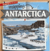
Readers will learn about a great mountain range buried under ice, massive glaciers, and the wildlife that survives the cold. Majestic photographs and detailed maps will engage readers as geographical, historical, and weather information introduce them to the fifth-largest continent on Earth.

Mapping Africa

2014
As the second-largest continent, Africa offers thousands of miles of tropical rainforest, desert, and highlands to explore. It's a font of natural resources and home to 1 billion people! Readers will trek through the many climate zones and cities found in Africa as they are introduced to the continent.

Ancient perspectives

maps and their place in Mesopotamia, Egypt, Greece, & Rome
2012

Mapping and navigation

explore the history and science of finding your way
2013
Explores the history and science behind mapmaking and navigation, featuring illustrated, step-by-step instructions for twenty projects designed to help students learn about the mapmaking and navigation processes.

Map my room

2014
Simple text and illustrations introduce maps and how to create a map of a room.

Maps, maps, maps

2002
Simple text and illustrations provide a basic introduction to different kinds of maps and how they are used.

Pages

Subscribe to RSS - cartography