atlases

Type: 
Topical Term
Subfield: 
a
Alias: 
atlases

Illustrated atlas

2003
Presents a brief history and key facts about each country including its size, geographical features, wildlife, and how its people live, work, and play.

The Simon & Schuster young readers' atlas

1991
A world atlas with maps and basic information about the geography, people, and economy of every country.

Atlas visual De La Tierra

1995
A visual guide that explains the making and shaping of our planet.

Reader's Digest Bartholomew atlas of the world

1987
Contains special features maps, charts, and tables, a section on statistics, reference maps, and an index.

Explora el mundo

atlas visual para ni?os
1997
An atlas of the world for children with information on plants, animals, industries, people, and cities for each continent.

Picture reference atlas

2000
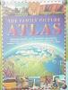
A picture atlas that provides a variety of information about the countries of the world, including the capital, flag, borders, rivers, crops, notable buildings, oil drills, animals, mines, and activities; and includes factfiles,as well as general information on the nature and use of maps.

First fun atlas

2003
A colorful atlas of the world that profiles each continent, providing fast facts, maps, and photos of unique sites and animals.

Mi primer atlas

1998
A collection of illustrated maps with quizzes and illustrated characters introduce geography.

The family picture atlas

1999
Presents color maps of the countries of the world, arranged in the four continental groups of the Americas, Europe, Asia, and Africa, each with information about the people of the country or region and the way they live; and includes vital statistics, such as highest mountain, capital, population, natural resources, and others.

Pages

Subscribe to RSS - atlases