Presents a collection of maps that chronicle the geographic and cultural boundaries of Europe, the Mediterranean, and the steppeland to the East during the Medieval period, illustrating trade routes, towns, and populations pattern as the Roman Empire fell.
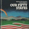
Contains maps of all fifty states as well as U.S. territories and Puerto Rico; and provides information on state birds, flowers, trees, nicknames, populations, and important dates. Includes glossary.
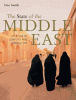
Combines clear, analytical text with full-color maps and graphics to provide a comprehensive guide to the politics and conflicts of the Middle East including the Arab-Israeli Wars, Iran and Iraq, U.S. presence and military spending, and the impact of Middle Eastern policies on the world.
Explores the geographical/ethnographic background, and cultural history of Africa, and features a tour of modern-day regions. Includes a chronological table, over ninety maps, and illustrations.
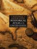
Presents an historical atlas of the United States and contains dozens of maps, comprehensive map index, historic photographs, time lines, and examines important subjects and events of American history.
Charts the rise and fall of Hitler's Third Reich through a series of essays, photographs, and maps that reveal information about populations, sites of attacks, political support, and other topics, and includes a timeline and statistical appendix.