Explains what maps are and how to read them, identifies the different symbols found on maps, looks at how maps are made, and provides instructions for mapping a classroom, school, neighborhood, town, state, and country. Includes activities.
Presents an illustrated guide to globes and various types of maps about countries, land, water, climate, people, the economy, and history, discusses latitude and longitude, how to read maps, and includes activities and a glossary.
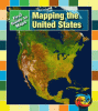
Illustrations and simple text describe what a cartographer does, the ways in which maps are created, and how maps are used to show the climate, history, and geography of the United States.
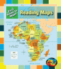
An introduction to maps, looking at different types of maps, explaining how to read maps and understand their symbols, and discussing map grids, latitude and longitude, and how maps are made.