children's atlases

Type: 
Topical Term
Subfield: 
a
Alias: 
children's atlases

The Kingfisher atlas of the modern world

2007
A collection of illustrated maps and detailed information about countries, conflicts, and people around the world from 1800 to the present.

My first atlas

2004
Maps and text introduce children to the countries of the world, with information about each country's climate, history, location, major cities, culture, and popular landmarks.

The children's atlas of people & places

1993
Maps, facts, and illustrations present the diverse places and people on our planet.

National Geographic Kids beginner's world atlas

2011
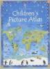
A beginner's atlas for children ages five to eight with full-color maps that reveal the geography of the Americas, Europe, Asia, Africa, Australia, and Antarctica, including ten physical maps, ten political maps, and information on people, places, and natural wonders from around the world.

The student's activity atlas

1993
Maps, activities, and text introduce regions and countries of the world and provide the opportunity to practice the reading of maps and the interpretation of atlas symbols.

The complete atlas of the world

1995
Describes the world's geography, its people, and their impact on the environment.

National Geographic student atlas of the world

2009
Presents a National Geographic Student Atlas of the World, with photographs and graphics of the planet, detailed maps, Web links, thematic indexes on a variety of topics, country flags, and fact boxes.

Discovering maps, a young person's world atlas

1991
An atlas introducing basic map skills through maps ranging from the Adriatic Sea to Zimbabwe.

The atlas of endangered places

1993
Text, photographs, and maps focus on areas of the world in which human activity is destroying the natural balance.

Pages

Subscribe to RSS - children's atlases